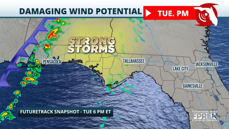
A cold front will approach from the Mississippi River Valley Tuesday and could produce a line of strong storms and damaging winds in the Panhandle Tuesday.
Surface analysis Monday depicts a strong low pressure located over the Red River Valley in the Upper Midwest. Tightly packed isobars, or lines of equal pressure, surrounding this surface low are resulting in a number of wind advisories in the Dakotas and Minnesota, where winds could be as high as 40 or 50 miles per hour. An attendant cold front stretches from Minnesota to Texas, with winds pulling warm and moist air into the Southern Plains Monday. This is expected to set the stage for strong and severe thunderstorms Monday afternoon from Texas to Louisiana. This area of severe potential will translate eastward by Tuesday, bringing the risk for damaging winds to the Lower Mississippi River Valley and Deep South.
A compact and intense shortwave is forecast to move into the Lower Ohio Valley by Tuesday. In the mid-levels, strong mid-level flow will help to provide extra lift in the atmosphere. Recent high-resolution model guidance suggests slightly higher dew points are possible in the Panhandle, which would only provide additional support for the development of strong and severe storms. There is some uncertainty regarding exact timing of severe storm potential and how it could impact overall impacts. Based on Monday's model guidance, there are two potential outcomes: one where the line of thunderstorms peaks in intensity Tuesday morning as it moves through the Lower Mississippi Valley and one where a line of thunderstorms will reinvigorate Tuesday afternoon as it moves eastward. Given the potential for a more robust moisture return ahead of the line of thunderstorms, the second outcome appears more likely to unfold across the Panhandle.
The Storm Prediction Center has much of the Panhandle west of Tallahassee under a "marginal" risk for severe weather. This designation is a 1 on a scale of 1-to-5 and means a few severe storms are possible, mainly overnight Tuesday and into early Wednesday. Damaging winds will be most likely given the robust environment ahead of the cold front, but large hail is also a possibility in some of the strongest cells. While the risk for tornadoes is low, lines of thunderstorms are known to produce quick spin-up tornadoes. The risk of tornadoes is highest across Mississippi and Alabama, where ingredients for tornado development align most.
Regardless of how the severe threat unfolds Tuesday into Wednesday, residents are encouraged to have more than one way to receive severe weather alerts. Since the risk of severe weather will be approaching during a time where many will be asleep, having those alerts turned on could be life-saving if warnings are issued.

