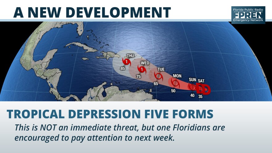
This story was updated to reflect the intensification of the former tropical depression into the fourth named storm of the season.
A new tropical storm formed 2000 miles away from the United States Saturday, and it’s likely to be of more interest to Floridians than one possibly forming in their own backyard.
The National Hurricane Center began advisories on Tropical Depression Five at 11 am Saturday, which later in the afternoon became Tropical Storm Dorian. The season's fourth named storm located 725 miles east-southeast of Barbados and moving west at 12 mph.

Forecasters at the National Hurricane Center have encouraged residents of the central and northern Lesser Antilles to closely monitor this system, as it could intensify into a hurricane by the time it passes through the island chain.
Tropical Storm Dorian is no immediate threat to Florida, but long range forecast data suggests it could move in the general direction of the northern Caribbean or southeastern United States in about a week. It is far too soon to credibly predict how strong it may be at that time or where specifically it would track.
Still Watching South Florida
Meanwhile in South Florida, a small swirl of a low pressure system was producing an area of disorganized showers from Miami to West Palm Beach Saturday morning. Forecasters at the National Hurricane Center still expect this system (referred to as Invest 98) to become a tropical depression or storm in the next 48 hours, but it does not pose a significant tropical threat to the state.
A tropical depression or storm is most likely to form from Invest 98 when it moves back over the warm nearshore waters of the Atlantic Ocean. Regardless of its tropical status, the presence of tropical moisture is likely to produce periods of heavy rain and stronger thunderstorm activity at times through Sunday, especially in areas near and east of I-95 from Melbourne to Miami.
Choppy seas and a high risk of rip currents are also in the forecast at most Atlantic Coast beaches this weekend. Local authorities and forecasters at the National Weather Service are urging all water enthusiasts, especially beach-goers and inexperienced swimmers, to use caution when entering the water. Conditions are forecast to gradually return to normal as the system pulls away early next week.
Copyright 2020 WUFT 89.1. To see more, visit . 9(MDA4MzM1MjM1MDEzMTg5NTk0MzNmOTQ5MA004))

