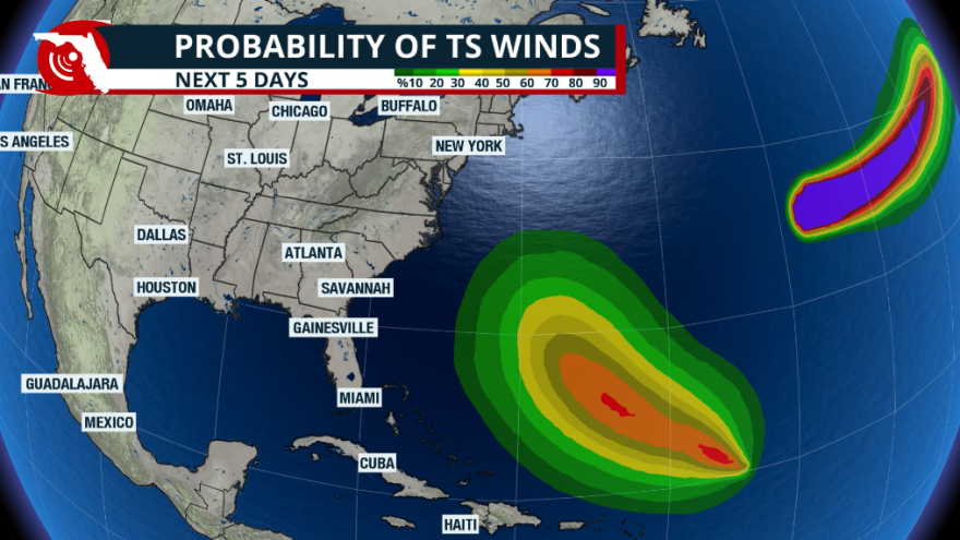
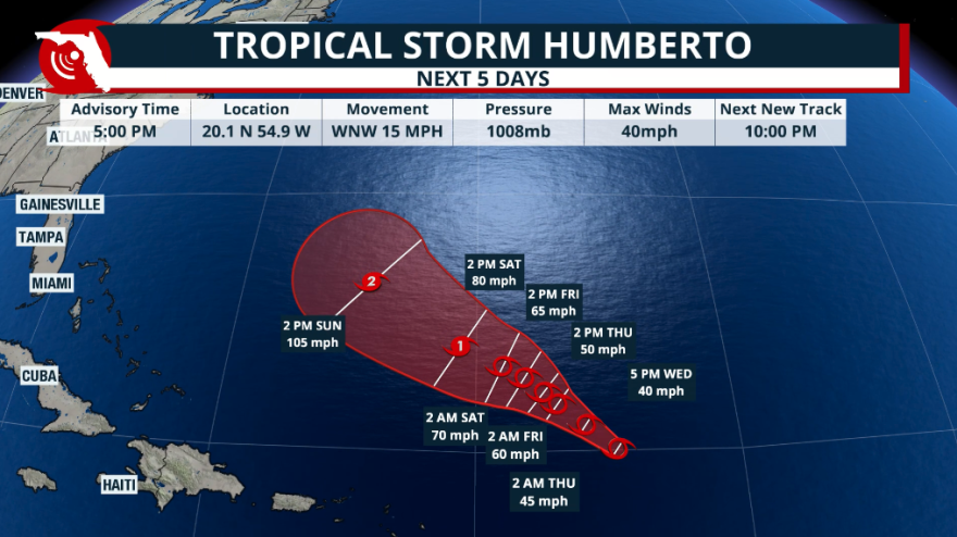
The National Hurricane Center has recently named Tropical Storm Humberto. The storm is located about 700 miles northeast of the Caribbean. This system is expected to slow down significantly over the next 24 to 48 hours as it moves northwest.
During the 5 o’clock advisory on Wednesday afternoon, the National Hurricane Center has Humberto moving west-northwest at 15 mph. However, by Thursday afternoon, this system could still be moving west-northwest, but at a speed of less than 10 mph at best. This slowdown will allow the tropical storm to gain a bit more definition and strength. By Saturday morning, Humberto will be over a favorable area with optimal conditions to become the next hurricane of the season, if this intensity forecast verifies, Humberto would become the third hurricane of this 2025 hurricane season.

By Saturday afternoon, Humberto will be gaining a little more speed as it moves west-northwest through the weekend, staying south of Bermuda. Humberto is likely to remain over the open waters just like Gabrielle did. The only difference is that Humberto will be moving a bit more west, west of Bermuda. This means that the small island couldn’t receive direct impacts early next week.
Also, looking at future models, Humberto is slated to grow not only in strength but also in size. This would mean that the East Coast, from Florida through the coast of the Carolinas, could experience higher seas and rough surf next week.

We will continue to monitor Humberto's track, but at the moment, Humberto does not seem to be a direct threat to the United States.
Tropical disturbance - Invest 94L
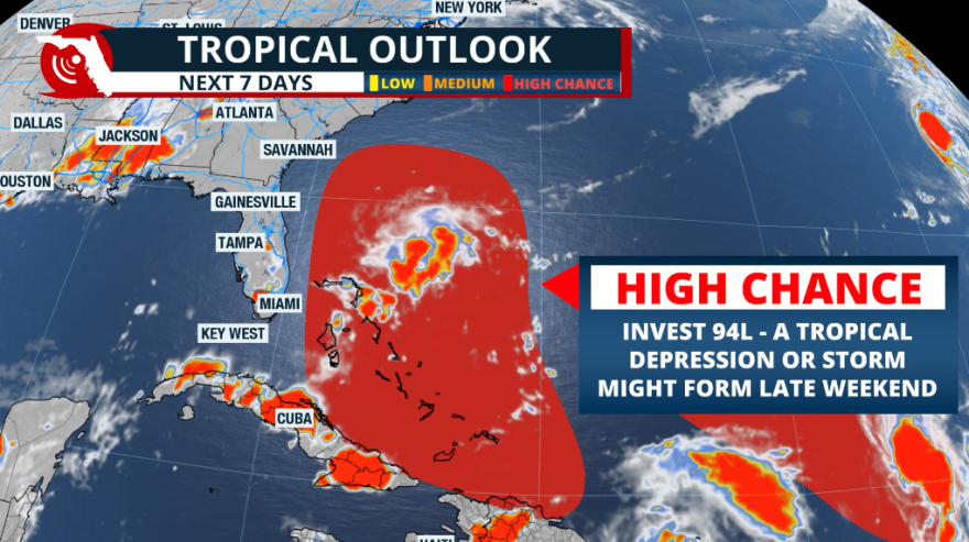
Invest 94L continues to travel over Puerto Rico. Tropical models indicate that this tropical disturbance will remain relatively weak as it is likely to move over or very close to the terrain and the higher mountains of Hispaniola. If the system is named, it will likely be named late this weekend. And if it gets named, it means that the system organized well enough to develop a well-defined center of circulation. If this happens, it would be over the southern portion of the Bahamas.

We will continue to monitor the system closely, as it could have direct impacts on Florida by early next week. Some models are still hinting at the possibility of having Humberto and what would be future Imelda, if it stays in a weak state, which is currently Invest 94, very close in distance. If this were to happen, we would examine more closely the possibility that the Fujiwhara effect might come into play. This means that the strongest storm will basically absorb the weaker system as one dances around the other. If two storms are relatively intense or similar in size, they will likely remain stationary or orbit each other.

