
-
 Martin CountyFlorida finished June as one of its 10 warmest on record despite cooler conditions in parts of the state. Forecasters are now tracking another prolonged stretch of dangerous heat.
 -
 A plume of Saharan dust is set to arrive to Florida, causing the storm chances to drop and temperatures to soar. Let's talk about the dust!


-
 Males and Florida lead the nation in lightning fatalities. Here are some lightning safety tips.
 -
 As Americans prepare to celebrate the nation's 250th birthday, weather records kept by Thomas Jefferson offer a fascinating glimpse into the conditions surrounding the adoption of the Declaration of Independence—and reveal how weather has helped shape America from the very beginning.
 -
 Florida will not be setting new hot records, but it will be extremely humid, and the temperatures will feel above 100 F every afternoon throughout the holiday weekend. How about the rain? There are some marine hazards too!
 -
 There were no recorded weather observations in Florida on July 4, 1776, but historical climate records can give historians a sense on what was going on.
 -
 A weak area of low pressure is meandering off the Southeast. Florida beaches could still see heightened surf and an increased risk of rip currents through the July 4th holiday.
 -
 In Florida, hurricane danger does not begin at landfall. Outer bands, tornadoes, and worsening travel conditions can start hours earlier, making timing one of the most important parts of storm preparation.
 -
 The remnants of a cold front could leave enough energy behind over the western Atlantic to ignite tropical storm activity east of Florida. What are the chances of this system developing, and where could it go?
 -
 Florida has historically seen limited tropical impacts during July. Tropical Storm Elsa impacted the region in 2021 and Hurricane Dennis made landfall in 2005.
 -
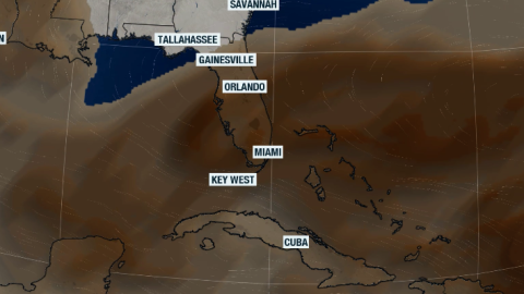
 Drought conditions are improving across many areas in Florida, but temperatures are about to soar, and chances of storms become more limited this weekend. Also, Saharan dust could be making the skies hazy.
 -
 A stationary front increases rain coverage across parts of Florida through the end of this week, while a high-pressure system builds just in time for the weekend, bringing temperatures near record heat or breaking records.


