As Imelda moves away from Florida, the few rain bands that have streamed in from the Atlantic will also continue to move away from the state. The winds, due to the counterclockwise rotation of Imelda, will be mainly from the north across the entire Peninsula. This will usher in drier air, which will suppress thunderstorm activity across much of the state.

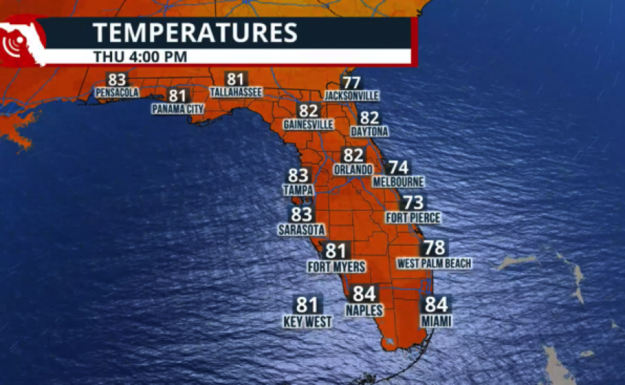
The weather is expected to remain mostly stable, with slightly lower humidity levels. With more sunshine, temperatures are expected to be near or slightly below average across Southwest Florida, Central Florida, North Florida, and the Panhandle. But Southeast Florida will be the spot where temperatures will feel the warmest due to the winds, which will be mainly from the west. These west winds are warm as they travel over land, and with the sunshine, they will soar to highs in the low to mid-90s.


The winds are expected to change as the week progresses. By Thursday, we will return to a more typical pattern, especially across the Peninsula area, while northern Florida and the Panhandle will remain predominantly dry. However, across Central Florida and South Florida, the winds will be from the east, accompanied by a plume of moisture moving in from the Atlantic. This combination will allow the showers and isolated thunderstorms as the day warms up.
Bye Imelda! Check out how Florida remains dry primarily on Tuesday, but showers and isolated storms return by Thursday, with the winds and a plume of moisture setting camp across the Peninsula. pic.twitter.com/pewAz91NZa
— Florida Public Radio Emergency Network (FPREN) (@FloridaStorms) September 30, 2025


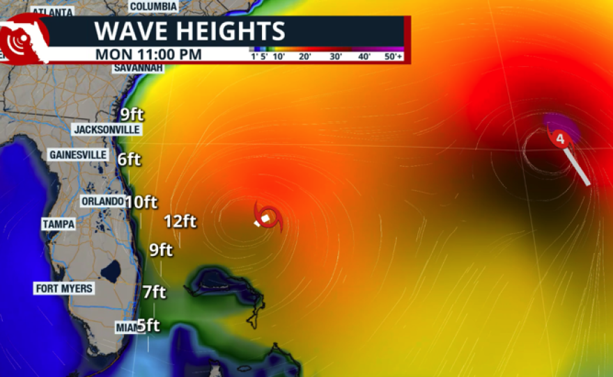
Please note that the seas will remain rough. Marine and beach activities are not recommended this week. Seas will remain above 6 feet across South Florida for most of the week, with higher seas dominating across east-central and northeast Florida beaches. There is also a rip current risk in effect, which is likely to remain in place, making the water hazardous for even the strongest swimmers. The reason for the dangerous seas to continue through the end of the week is a high-pressure system to the north of Florida and a weak stalled front over the state that will increase the wind gradient, which brings breeze conditions, and this will impact not only the east coast but also the Gulf Coast, including the Panhandle's coastline, through at least Friday.