

As Bertha moves away from Florida and makes landfall in southeastern Louisiana, the Florida Peninsula will return to a more typical weather pattern for this time of year. That means hot temperatures along with good chances for afternoon thunderstorms.
A wide view of the wind directions and speeds paints a clear picture of how the weather pattern will change. There will also be moisture inflows from the southeast that will first enhance shower activity across South Florida. pic.twitter.com/5FL0k1DTj2
— Florida Public Radio Emergency Network (FPREN) (@FloridaStorms) July 22, 2026
When we zoom out, it's clear that the wind pattern across the peninsula is changing. While Bertha was over the eastern Gulf, winds were mainly out of the south-southwest. There was also a pocket of dry air that kept much of South Florida mostly sunny, while the eastern half of the peninsula experienced mostly dry conditions. The heat and humidity were still present, but overall, the weather pattern remained fairly rain-free for several days.

As the second named storm of the Atlantic hurricane season moves away from Florida, it allows the wind pattern across the peninsula to change. Check out the wind speeds and directions over the next few days. By Thursday, a high-pressure system over the eastern Atlantic will bring easterly winds across much of Florida's East Coast. We will also see a surge of moisture arriving from the southeast, increasing rain chances and atmospheric instability across South Florida.
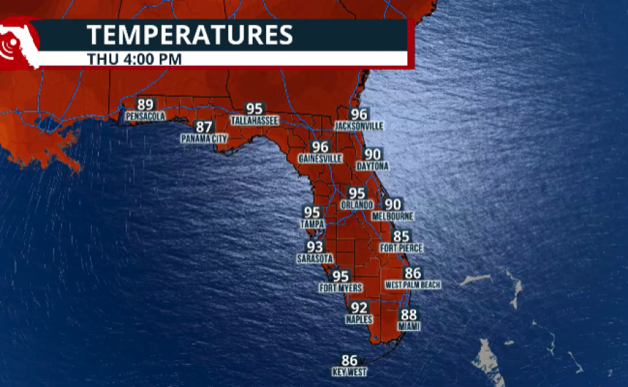
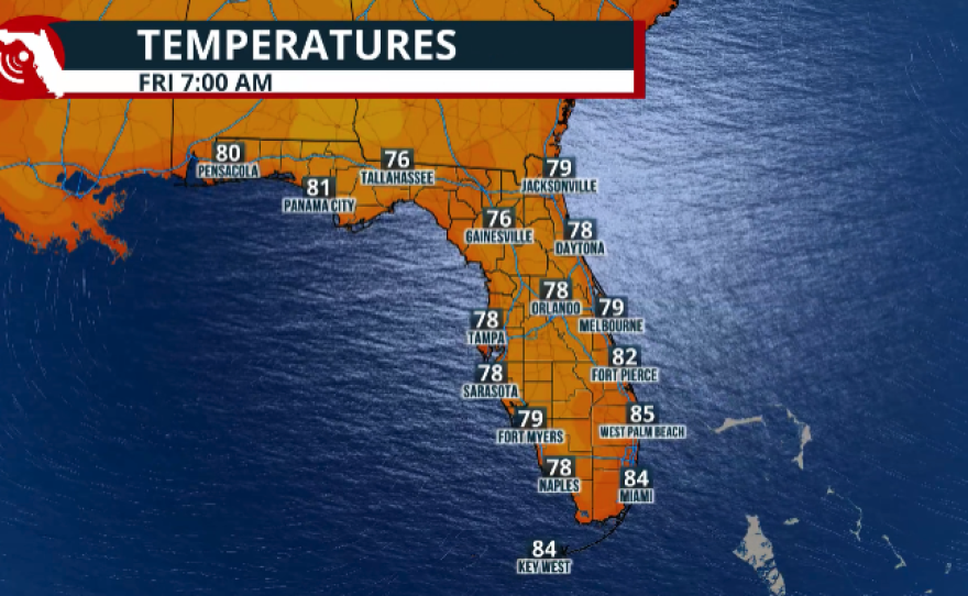
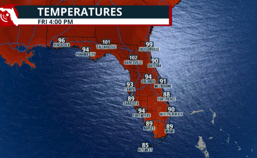

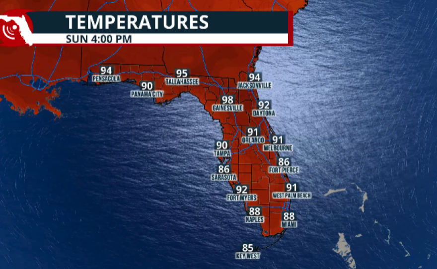
With high temperatures climbing into the lower 90s across Southeast Florida, we can expect the Atlantic sea breeze to develop. The easterly winds will push much of the afternoon precipitation toward the interior and Southwest Florida. A similar pattern is expected across Central Florida, where thunderstorms will also be driven inland and toward the Tampa Bay area.

We can expect a similar weather pattern on Friday, with winds remaining primarily out of the east across the peninsula. A few morning showers may move across the Treasure Coast before deeper moisture arrives from the east-southeast. That additional moisture will become established by Saturday afternoon, likely leading to a higher chance of showers and thunderstorms across the interior of the peninsula.

Looking ahead to the weekend, a frontal boundary is expected to approach from the north and could stall just north of Florida. If the front pushes closer to the Sunshine State, periods of heavy showers and thunderstorms could develop across North Florida and portions of the peninsula on Saturday and Sunday. This could result in isolated flooding in some locations. We will continue to monitor this setup and the exact position of the frontal boundary, and we'll bring you updates later this week.
Storm surge up to 3 feet high is possible between today and tomorrow. Wave heights may also get between 2 to 7 feet tall near the shore. Avoid swimming in the water during this time. pic.twitter.com/KufVGvkNQJ
— Florida Public Radio Emergency Network (FPREN) (@FloridaStorms) July 22, 2026
