A Flood Watch is in effect across parts of the Florida Panhandle from mid-morning Saturday through at least early Monday. The alert, which indicates that conditions are favorable for flooding, covers the western half of the Panhandle, including the cities of Port St. Joe, Panama City, DeFuniak Springs, and Pensacola.

A stalling frontal boundary will interact with a very humid tropical airmass this weekend and this should will fuel the development of several rounds of heavy rain and thunderstorms. Rainfall accumulations for the alerted areas could range between 3 and 6 inches between Saturday and Tuesday. Locally higher amount will be possible.

Such heavy rainfall over a short period of time could overwhelm the ground, drainage areas, and local waterways, and the risk of flooding is elevated.
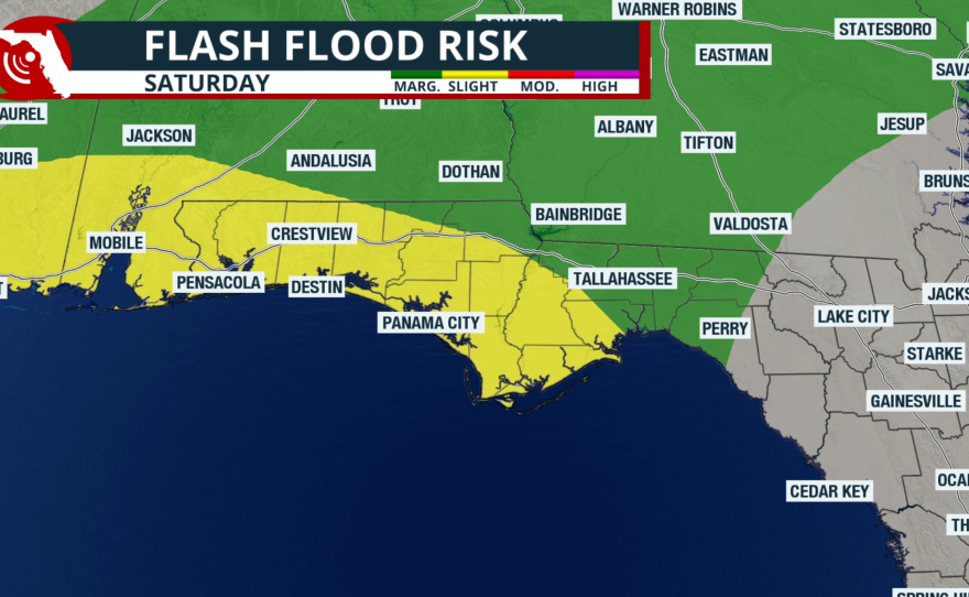
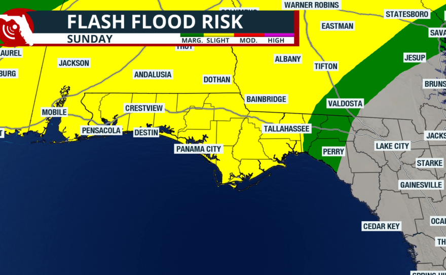
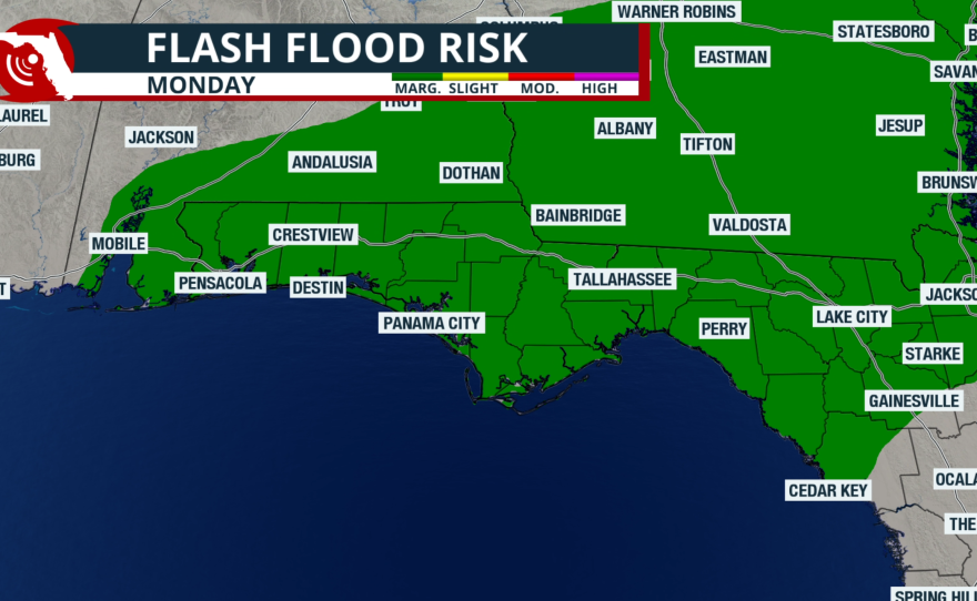
Experts at the Weather Prediction Center include parts of the Florida Panhandle in a “slight” or Level 2 out of 4 risk for flash flooding on Saturday and Sunday. Although some rain is possible on Monday, chances will be lower than the weekend, and the flood risk will relax to “marginal” or Level 1 out of 4.

In addition to the risk for flooding, onshore winds will create dangerous conditions at Panhandle beaches this weekend. Minor coastal flooding is expected at high tide times, and rip currents are highly likely.
The frontal boundary partially responsible for the unsettled pattern this weekend should pass through the Panhandle early next week, and stall over the Florida peninsula. Once the front passes, humidity levels should drop and temperatures will temporarily cool. In addition, winds could become blustery from the northwest, and this could create rough marine conditions over the northeastern Gulf.
For up-to-the-minute alerts for your immediate area, download the Florida Storms app, available on iOS and Android devices.