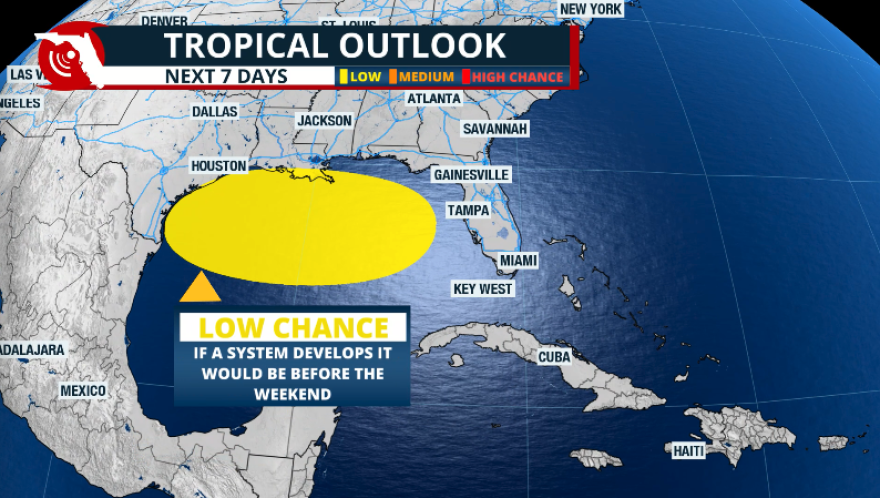
No, you’re not reading a story from last week. The same area that we were monitoring a week and a half ago, which had a low chance of tropical development, now has a low chance of development over the next five days.
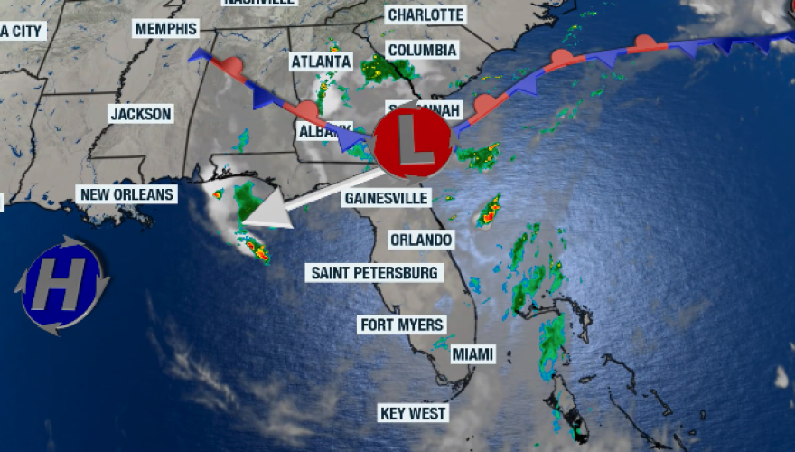
We meteorologists have been monitoring this situation closely, and we can identify that this same pocket of moisture is the same one we were watching a week and a half ago. The humidity has already moved over the Southeast and will be pushed again over Florida. Some heavy storms developed on Tuesday afternoon, covering much of the Peninsula as the first round. A weak low-pressure system is developing and will continue to bring a higher-than-normal chance for thunderstorms over Florida through at least Thursday. The Panhandle will experience thunderstorm activity related to this moisture and instability through Friday.

The National Hurricane Center gives a 10% chance for tropical development once the low-pressure system moves over the northern Gulf of Mexico. Similarly to what happened around July 11, the system is expected to hug the Gulf Coast. There is a small window of time for the system to develop, as a high-pressure system will be taking over, and it’s likely to absorb the low-pressure system if it were to develop at most. The water over the Gulf is warm, and the wind shear could be weak enough to allow a weak organization before it reaches land. If anything develops, it won´t be a windstorm; it will bring heavy rains.
A low-pressure system is expected to move over the Gulf. If* a system does organize enough over the warm waters, it´d be this week and is expected to bring heavy rains, rather than winds. The chance is low, but heavy rains are expected from Louisiana through SE Texas regardless. pic.twitter.com/3neKoRNLWh
— Florida Public Radio Emergency Network (FPREN) (@FloridaStorms) July 23, 2025
However, we must closely monitor this area, as if it remains over water for too long, it could develop before making landfall somewhere along the central Gulf Coast or even in southeast Texas. Regardless of tropical development, residents from Louisiana to the northern Texas coast can expect heavy rains by the end of this week and likely into the weekend.
We will continue to monitor this closely and provide updates as the system moves over the Gulf.

