The winter storm that has wreaked havoc across much of the United States, including impacting over 200 million people, is dragging in a cold front. The cold front is about to enter Florida and has sparked a few strong-to-severe thunderstorms across the western Panhandle.
The storms will continue to push eastward and move closer toward the Tallahassee area this afternoon. The biggest risks from these thunderstorms include damage, strong winds, and isolated tornadoes.
Severe Thunderstorm Warning for Gadsden, Jefferson, and Leon County until 6:00pm EST. Details on the Florida Storms app. #flwx pic.twitter.com/JKp9FEIHcu
— Florida Public Radio Emergency Network (FPREN) (@FloridaStorms) January 25, 2026
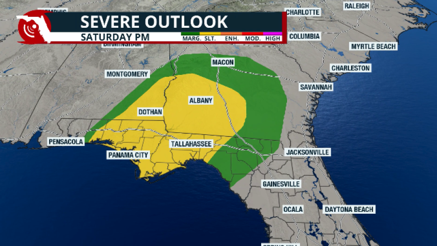
The Storm Prediction Center has placed much of the Panhandle under a slight risk for severe thunderstorms, and from Tallahassee over to the northwestern fringe of North Florida is under a marginal risk. This means that this cold front is losing its punch as it continues to move eastward. The reason for this is that cooler air is quickly filtering in, stabilizing the atmosphere.

For the rest of Florida, we’re not expecting the cold air to quickly move in. It will take a while for the cold air to take over Florida. The coldest air will remain focused, mostly over the panhandle and parts of North Florida. Well, South Florida will have cooler temperatures that will linger through much of the week. This will not be the coldest temperatures we have experienced this season.
Some severe storms sweep through the Pahandle this afternoon. An extreme cold warning is in effect for the western portion of the Panhandle through Monday afternoon. Freeze watches are in effect through North Florida for Tuesday. pic.twitter.com/zQ64oWFUYT
— Florida Public Radio Emergency Network (FPREN) (@FloridaStorms) January 25, 2026
The forecast for Florida
By Monday morning, the cold front will be pushing across Central Florida, bringing only a slight chance of a brief, very isolated passing shower.
As for temperatures, there will be a sharp difference over relatively short distances. For example, between Gainesville and Tallahassee, there could be a 20° difference in temperatures on Monday morning. The Gainesville area will likely wake up to temperatures around the upper 50s to low 60s, while the Tallahassee area will be between the upper 30s and low 40s.
During the day, the temperatures will be dropping across North Florida. The highest on Monday afternoon will remain around the mid-upper 50s across North Florida, while the panhandle will remain around the upper 40s.
The sharp temperature contrast will continue to push farther south in the afternoon. South Florida will reach the low 80s wall areas across Central Florida will have highs around the upper 60s.
Freeze alerts are in effect for Florida on Tuesday morning.
By Tuesday morning, it’s when much of the state will experience its coldest temperatures. The panhandle will wake up to temperatures around the low to mid 20s. The winds will be gusty, so the windchill factor won’t be much lower, but there will likely be freezes during the morning on Tuesday.
Across Central Florida, temperatures will remain around the low 30s, and stronger winds could make them feel around the upper 20s. But the winds will be subsiding during the morning hours on Tuesday.
Across South Florida, temperatures on Tuesday morning will be around the mid-50s in the southeastern area, while the southwest will be colder, around the mid-40s. For the entire South Florida area. There could be lower windchill values as winds will be coming in from the north, gusting up to 25 mph.

With the winds remaining mostly strong across parts of both coasts of Florida from the central region southward, there will also be several small craft advisories in effect through at least Tuesday. But South Florida will likely stay with the small craft advisories in place at least through Thursday afternoon.
As far as the rain, the front will continue to fizzle out as it pushes south, and we are expecting mostly clear skies by Monday night, which will likely stay mostly clear in the evenings and mostly sunny in the afternoons across much of Florida at least through Wednesday.


