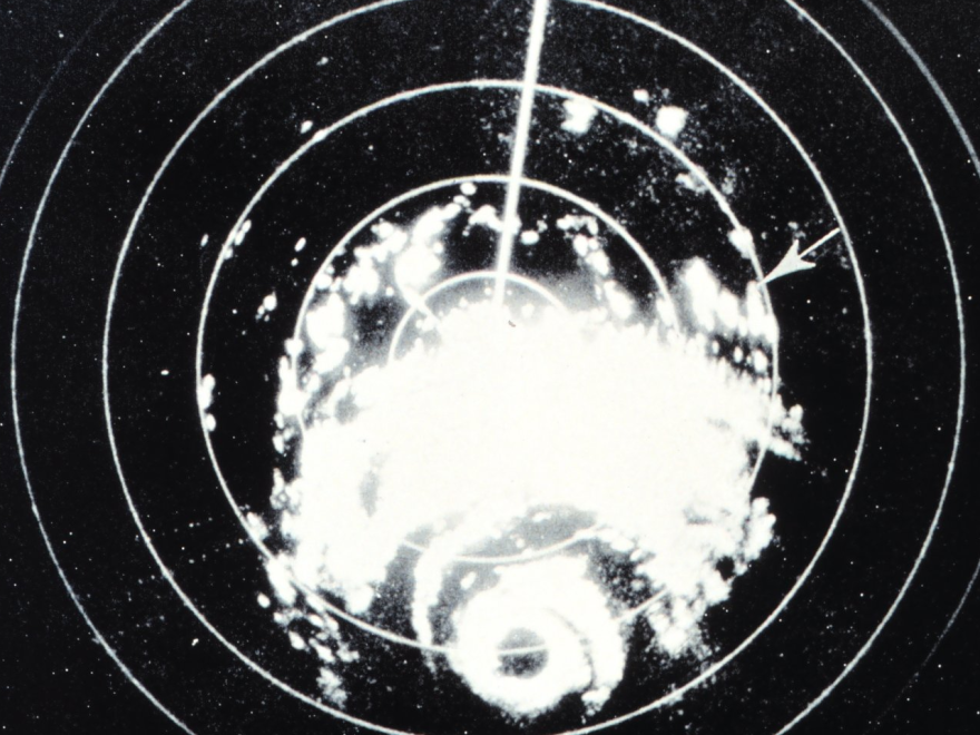
As the 20th century moved forward, so did weather technology.
One vital area of advance was a better understanding of how and why hurricanes formed — and where they were going. Here is part two of our three-part series as the 2022 Atlantic hurricane season gets underway.
After the “Great Storm” — a Category-4 hurricane that hit Galveston, Texas, in 1900 — radio developed into the predominant mass medium. But while it made great inroads in the 1920s, John Cangialosi at the National Hurricane Center in Miami says for severe weather, it was a day late and a dollar short.
“When it comes to radio, that was also intermittent and not the best,” said Cangialosi. “Sure, there were advancements, but you probably remember that these instruments were so much inferior to what we’re dealing with today. But it was still an advancement at the time.”
The first half of the 20th century also saw the coming of a tool that would eventually become an essential part of hurricane prediction and tracking — and Cangialosi says all it took was a global conflict to bring it about and really open the door to learn about weather.
Today’s weather radios are vastly better than the sets that brought America “Fibber McGee and Molly” and Edward R. Murrow. Strictly dedicated to transmitting from the National Weather Service, they can bring out severe weather information in a matter of seconds.
“One of the most reliable ways to receive alerts is the NOAA weather radio,” said Dwight Koehn a meteorologist with the National Weather Service in Albuquerque, New Mexico, appearing in an agency video.
NOAA weather radios are broadcast 24/7 through the 122 Weather Service offices nationwide. The warnings cover various types of hazards.
“Including natural, environmental, and public safety; that means you’ll also receive alerts regarding earthquakes, avalanches, chemical releases, and Amber alerts,” Koehn said.
The use of radar evolved into a staple of hurricane forecasting today — the hurricane hunter aircraft — which flies into the storms, recording and sending back vital data on conditions.
NOAA’s fleet includes a pair of P-3 Orion Turbo prop aircraft, and a Gulfstream 4-SP jet. The Orions fly through the storm, while the Gulfstream flies above the storm, gathering data from the upper atmosphere. The aircraft are crammed with high-tech equipment.
“Like radar, fixed probes that measure particle in the air,” the video said. “Scientists also deploy drop windsones, which parachute down through the hurricane to the ocean’s surface sending back data on pressure, temperature, humidity, and wind. These measurements can help us understand the structure of the storm and the winds that are steering it.”
The data are collected and used to make computer models that help forecasters predict how intense the hurricane will be — along with where and when it will make landfall.
In the technology evolution, the telegraph begat radio, which begat television — and the NHC’s John Cangialosi says it was then that hurricanes and other severe weather began making their way visually into people’s homes.
“Television was revolutionary in terms of communication,” he said. “Once television was out there, people essentially used them to get information; it was a better mechanism to deliver that information. And as a meteorologist, that helps out our community greatly, because we were able to have a real direct link with the general public to help communicate warnings and impact and things like that.”
Brad Baker, assistant administrator in Santa Rosa County and former public safety director, goes back to Hurricane Dennis in 2005, in watching the technology develop.
“We always relied on the National Weather Service; I just think they’ve evolved with their technology to where they can predict a little better, at least with landfall,” he said. “I think they’re still struggling with the size and intensity [of storms]. And definitely, our ability to track resources and manage the [emergency operations center] component is much easier.”
One advance that’s affected weather forecasting across the board, from drizzle to a major hurricane, has been the development of cyberspace. Baker says social media has changed a lot of disaster responses.
“It just gives you the ability to tap in — you can see almost instantly your damaged areas,” Baker said. “It’s changed our damage assessment; even though we still have to go out, we can monitor it and see the area that we need to focus on first. We did not really have that during the response to Ivan (2004) and Dennis.”
Working a post-storm scenario online also helps provide a lot of what Baker calls “historical references.”
“People just document so much more on their social media; granted it has its challenges as well,” said Baker. “People like to get on there and prank people and they post false information,” he said. “It’s a struggle to make sure we have the right communications out there. So while it’s helpful, it also makes it more challenging to get the correct word out to everybody.”
Baker is quick to add his voice to those who contend that even the best technology is useless if nobody’s paying attention.
Copyright 2022 WUWF. To see more, visit WUWF. ![]()

